SOCIAL
QUICK LINKS
CONTACT
Copyright Breedveld Enterprises Limited 1985-2024                                         
Cadvision is a registered trademark of Breedveld Enterprises Limited
RasterTech is a registered trademark of Breedveld Enterprises Limited
Choose bundled solutions:
(request a quotation for best pricing)
Prices are indicative, local currency pricing is subject to fluctuations due to exchange rates.
Quotations are good for 14 days from date sent

nanoCAD 3DScan is specialized software designed for processing 3D scanning data and tackling engineering and informational challenges across fields such as geodesy, mechanical engineering, construction, infrastructure, and metrological monitoring. It operates as a downloadable vertical application on the nanoCAD platform.
You can get a license for 1 or 3 years.

3DScan for Laser Scanning Data Processing

Professional Tool for Laser Scanning Processing


3D scanning is in demand in areas where analysis of the shape and placement of real-world objects is required. It's used in design, modernization of industrial facilities, topographic mapping, and assessment of parameters for existing, planned, or under-construction objects, among other applications.

nanoCAD 3DScan features a comprehensive suite of data processing tools, expanding the possibilities when working with point clouds and enabling the resolution of nearly any challenge:
Preliminary analysis and processing of 3D scanning results
Classification and segmentation of point clouds
Creation of Digital Surface Models (DSM) and Digital Elevation Models (DEM)
Layer-by-layer vectorization and floor plan construction
Detection of basic geometric shapes and complex technological systems
Area and volume calculations
And more.

Over 150 commands that implement the main stages

of 3D scanning data processing

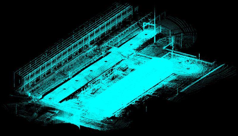
Classifying and verifying ground

An algorithm for automatic ground identification, complemented by a ground verification command that allows for manual refinement of automatically classified points.

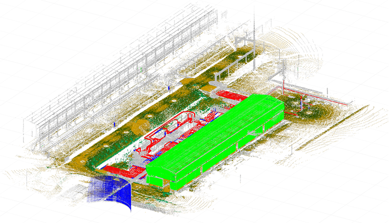
Classifying points and establishing named views

An extensive toolkit and parameters are available for the automatic classification of terrain and other categories based on specified criteria.

Layer-by-layer vectorization and floor plan generation

Automatic construction of multiple sections of point clouds at specified intervals, followed by their vectorization and the generation of raster images.

Creation and editing of 3D meshes

The command conducts 3D triangulation of volumetric object point clouds, creating meshes that can be used for triangulating buildings and other surface structures.

Global searching for features

The command identifies basic geometric shapes (plane, sphere, cylinder, cone, torus) within a point cloud.

Comparison of point clouds

The tool enables evaluation of the degree of alignment between two point clouds or between a point cloud and a model.

Registering point clouds by reference points with error control

Mutual orientation of multiple point clouds enables registration to identify transformation parameters for any number of reference point groups. Two techniques are employed: pairwise and iterative.


Show more features of nanoCAD 3DScan


RasterTech® New Zealand
"giving you the right image"
PO BOX 3087
New Plymouth, 4312
NEW ZEALAND

Ph:        +64 6 769-6864
Fx:        +64 6 769-6864
email:    admin@rastertech.co.nz